All the services we offer
One source for all visual needs
Why choose between specialists when you need both
Real estate agents need aerial shots and ground photography. Industrial clients need thermal imaging and progress documentation. We do it all without juggling multiple vendors or waiting for different schedules to align.
.jpg)
Photography that sells
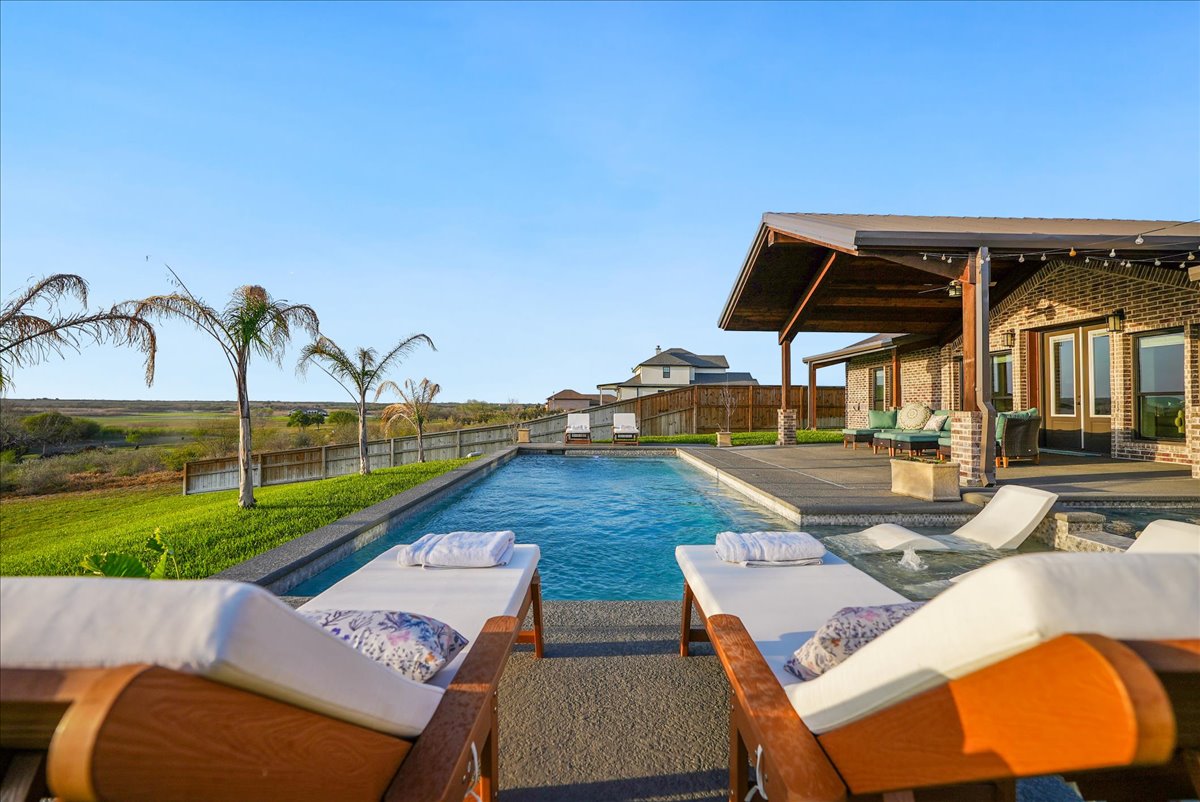
Real estate photography that stands out
Good lighting and composition make the difference between a listing that sits and one that moves. We know how to present a property so buyers see its best self.
.jpg)

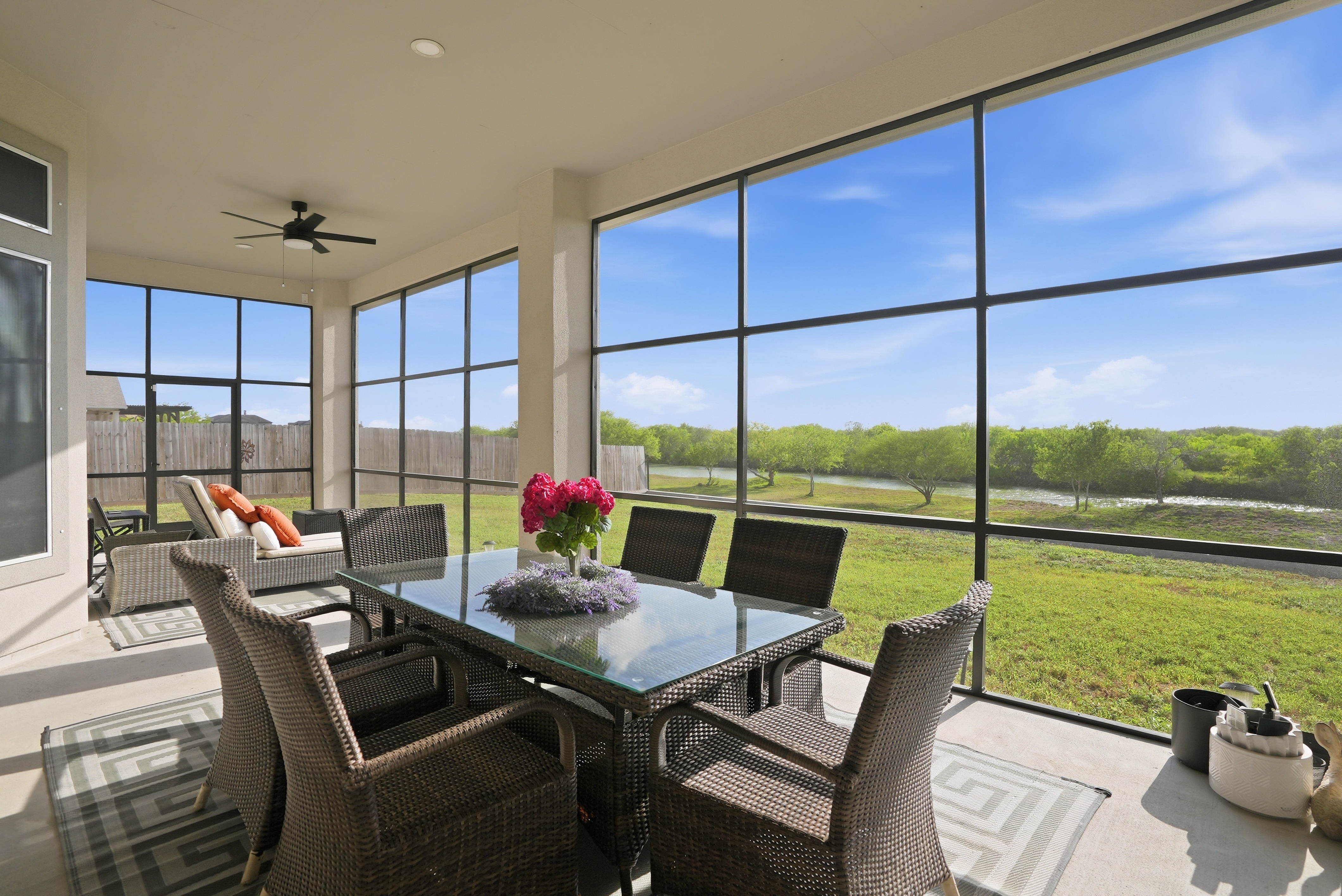
Airbnb photography that fills your calendar
Guests decide before they arrive. Sharp, inviting photos mean higher booking rates and better nightly rates for your property.
Matterport tours that close deals remotely
Buyers walk through every room from anywhere. It qualifies leads fast and saves serious time for agents managing multiple showings.

Quick delivery without compromising quality
The market moves fast in South Texas. We deliver results on time because we understand that speed and quality go hand in hand when you know your craft.
Drone services for business
Thermal imaging, construction documentation, solar inspections, utilities, oil and gas operations, and animal recovery across South Texas.
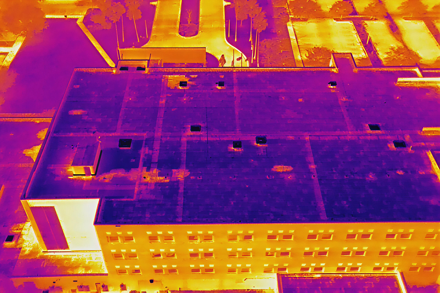
Thermal imaging for roof inspections
Thermal drones detect suspected moisture and identify problem areas on roofs. Precise data helps contractors plan repairs and prevent costly damage.
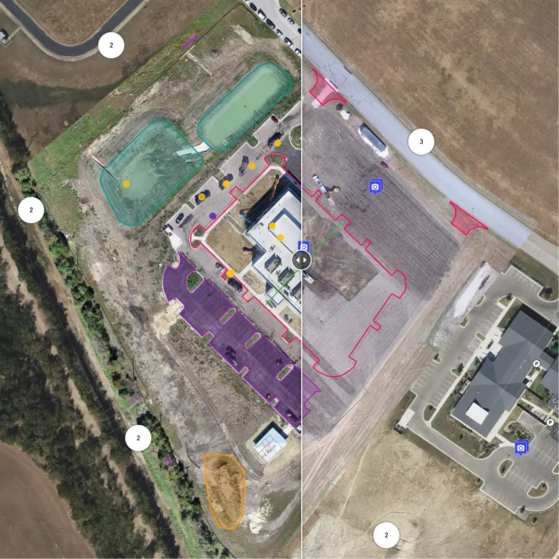
Construction site documentation
Aerial footage tracks project progress from start to finish. Regular drone documentation provides clear evidence of work completed and timeline adherence.
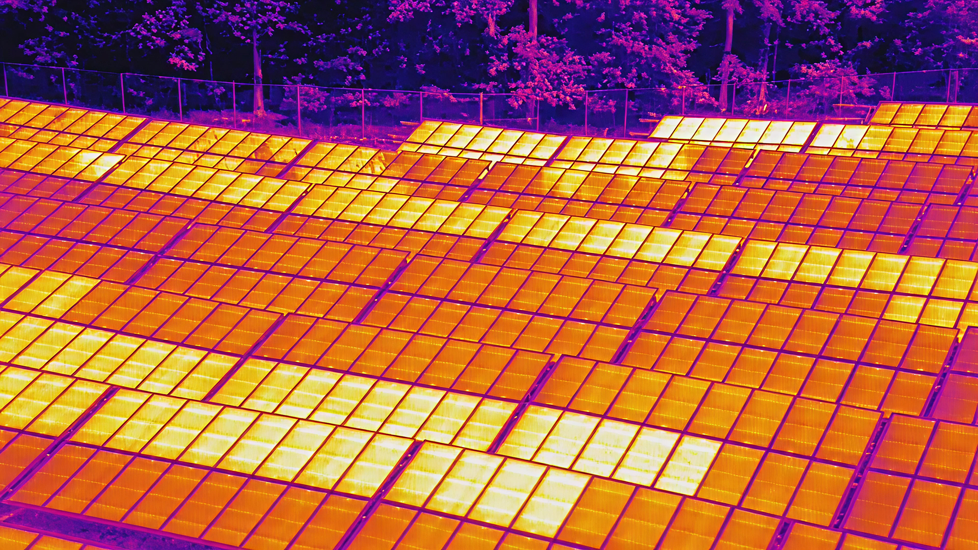
Solar panel inspection and assessment
Drones inspect solar arrays quickly and safely without climbing. Thermal imaging reveals panel efficiency and identifies underperforming units.
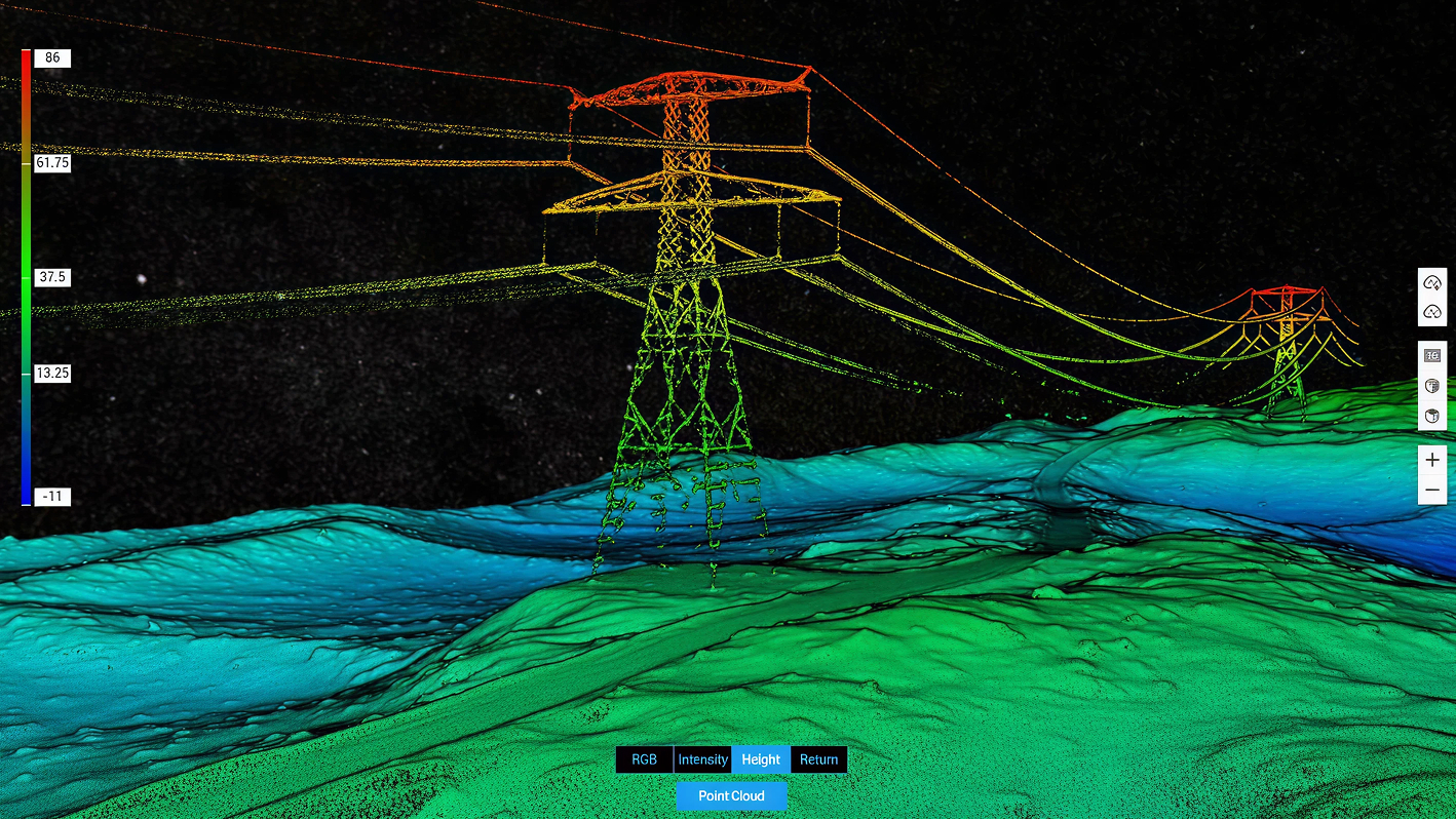
Utilities and infrastructure monitoring
Aerial surveys map power lines, pipelines, and utility corridors with precision. Drones reduce risk and improve efficiency in infrastructure management.
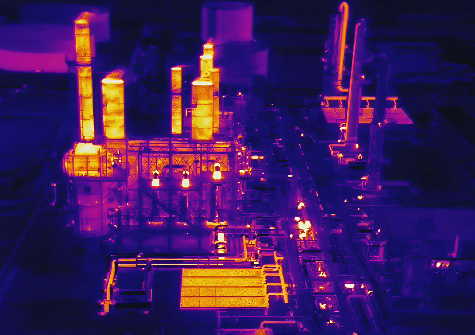
Oil and gas operations support
Drones monitor drilling sites, tank farms, and pipeline routes. Aerial documentation ensures compliance and provides operational intelligence.
Ready to get started
Contact South Texas Photography for a free consultation about your project needs
