All your photography needs in one place
From real estate listings to industrial drone inspections South Texas Photography delivers Aerial, Thermal, LiDAR, and Matterport services that make every property look its best and every job site run smarter.
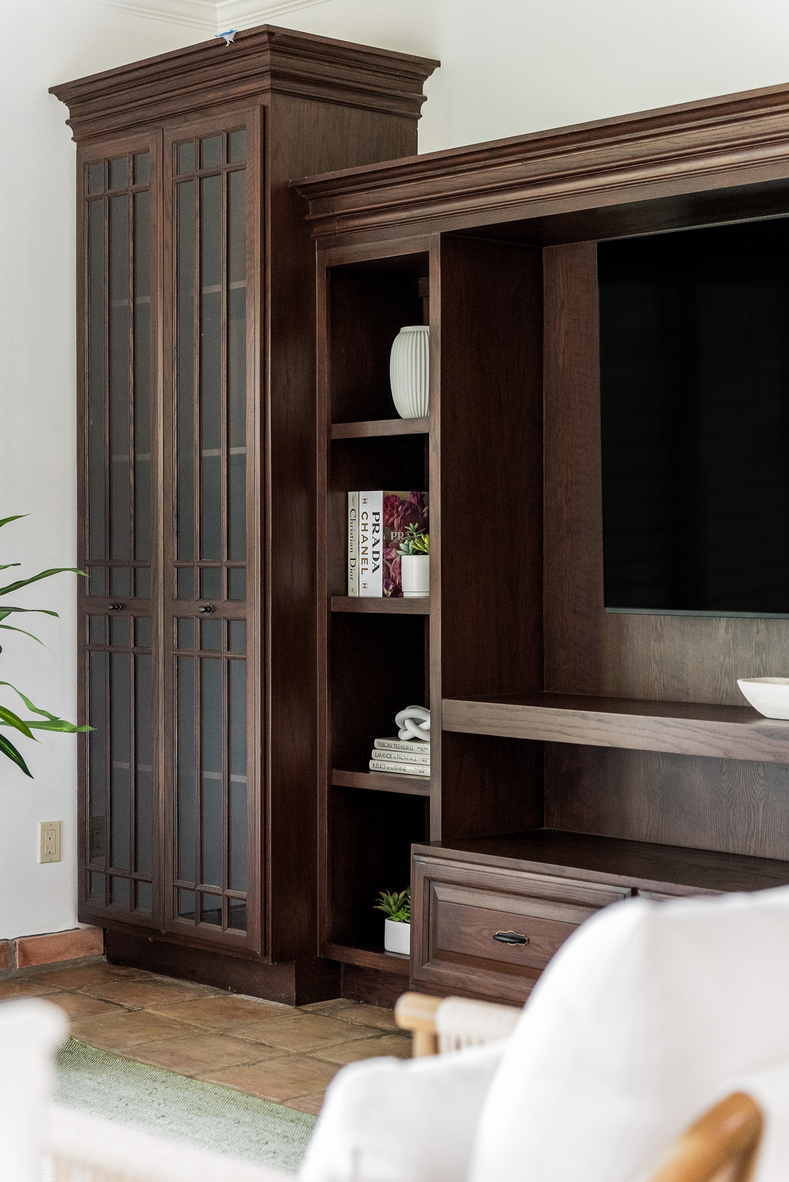
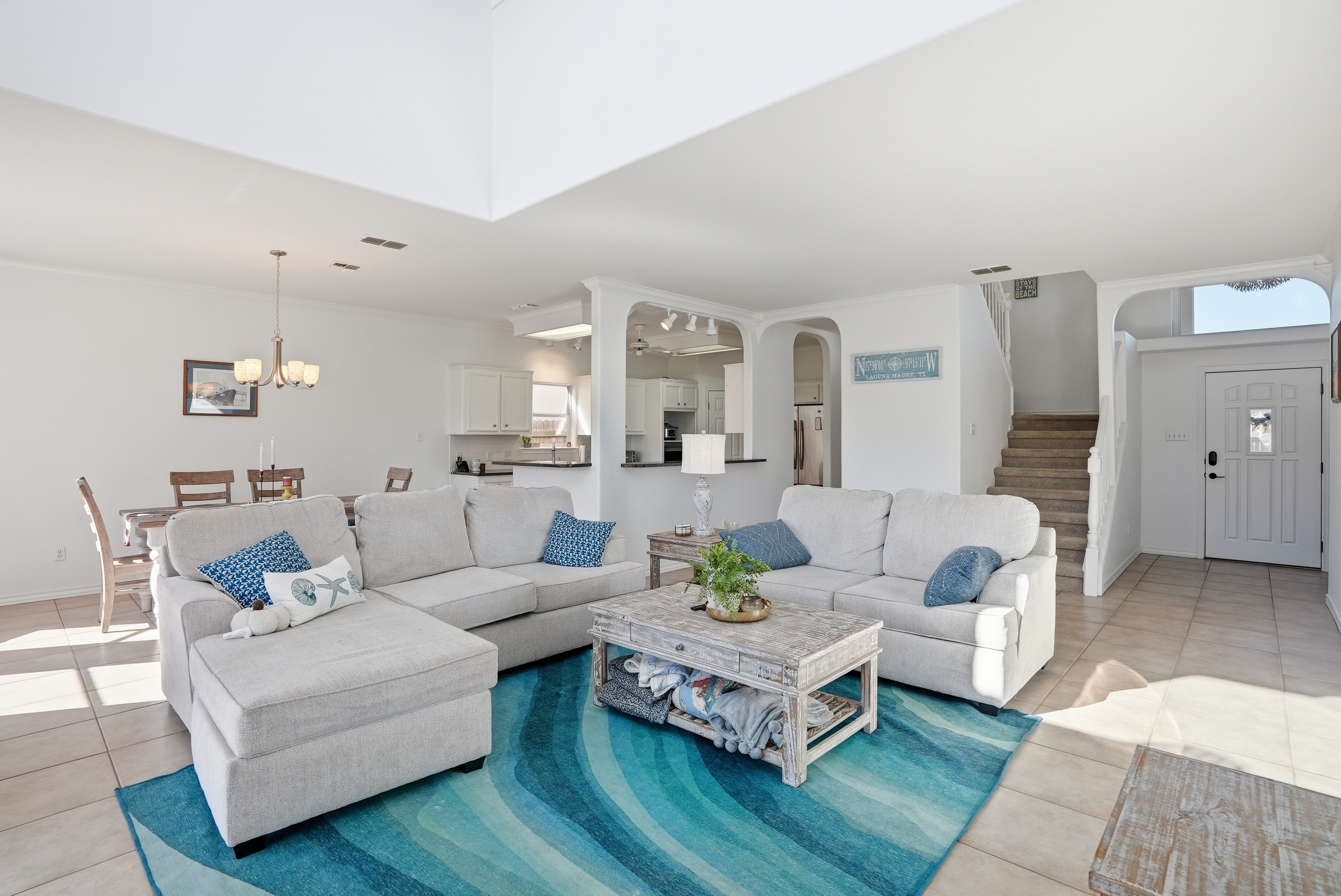
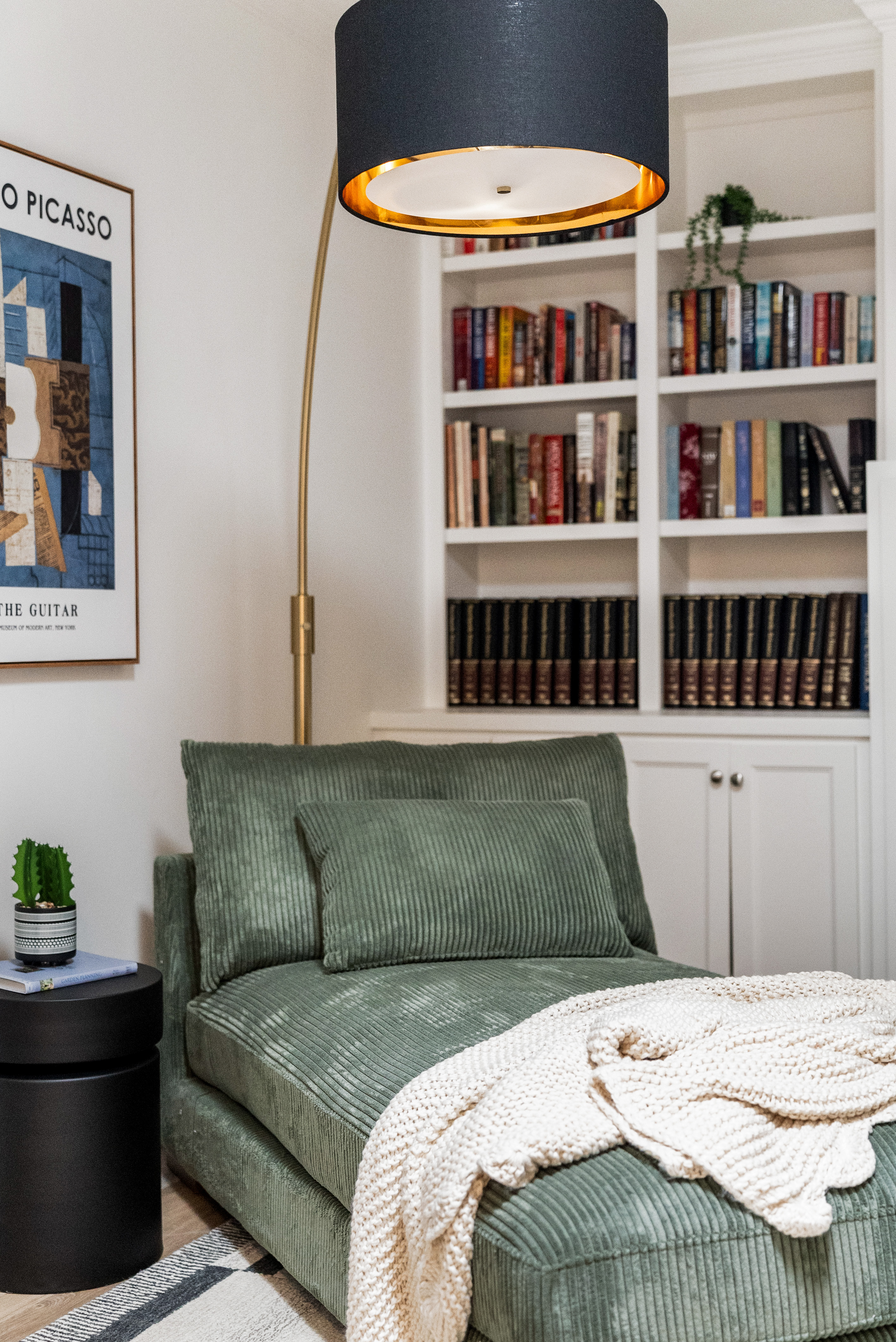
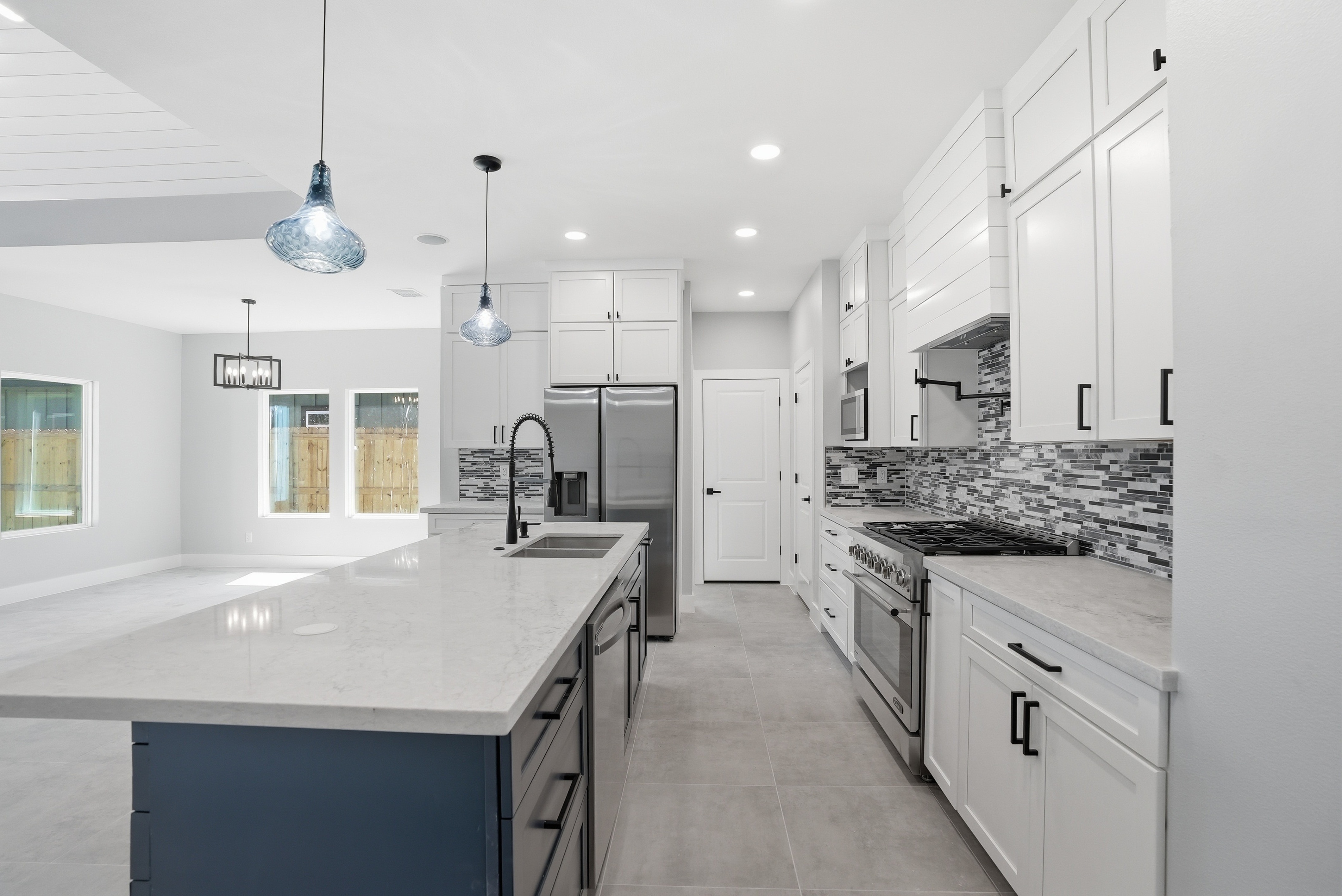
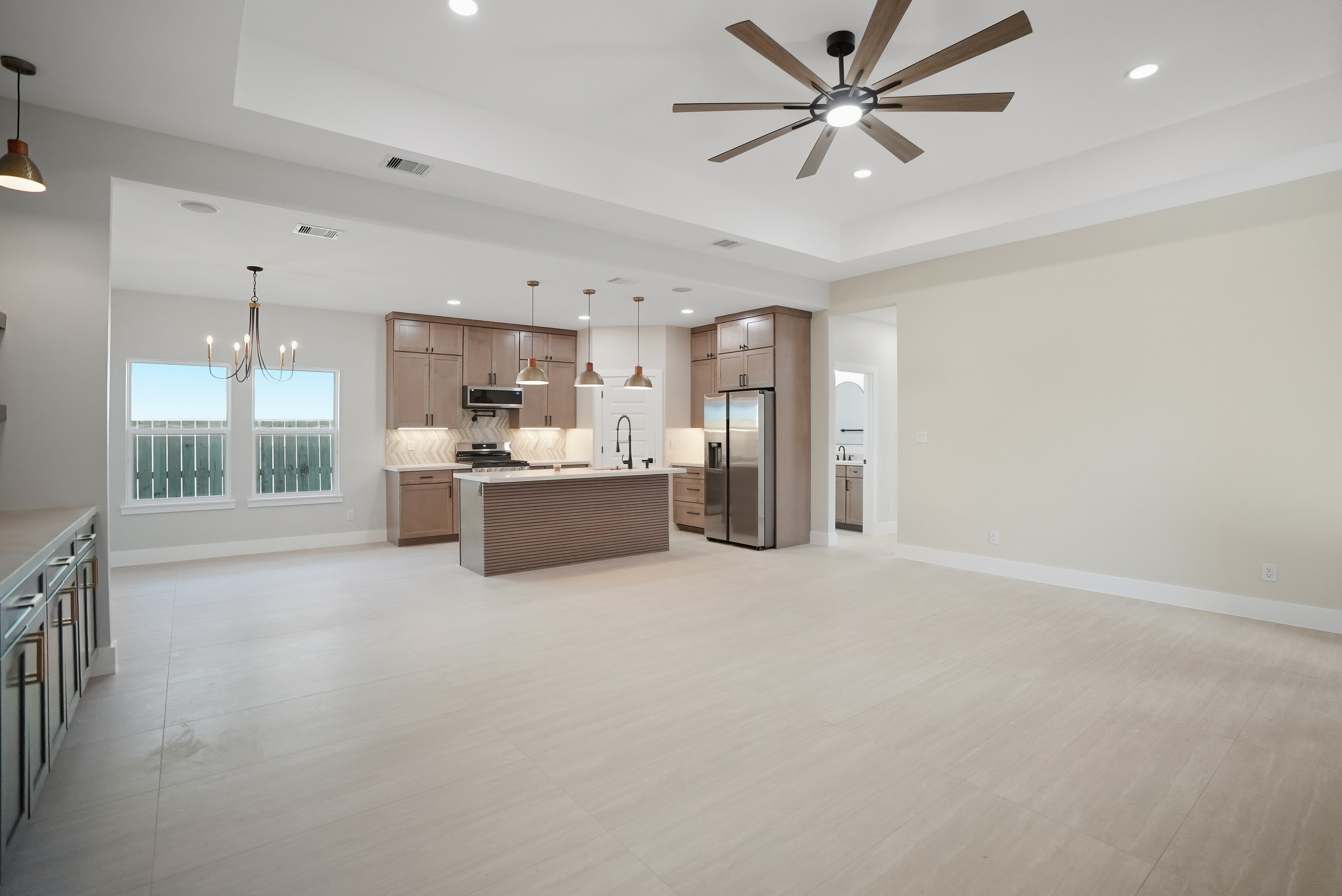
Real estate photography that closes deals
Ground-level shots and aerial views showcase properties the way buyers want to see them. Professional photography moves listings faster and commands better prices.
Thermal inspections reveal roof damage early
Moisture, leaks, and insulation problems show up instantly on thermal scans. Know what's wrong before expensive repairs become necessary.
Industrial drone work for infrastructure operations
Construction progress, asset assessment, and utility inspections from the air. Certified pilots deliver the precision your project demands.
LiDAR drone, Survey Smarter. Map Faster. See Further.
Traditional surveying can't keep up with the scale of South Texas. Our LiDAR-equipped drones cover vast terrain in a fraction of the time, producing highly accurate point clouds, elevation maps, and photogrammetric data that engineers, developers, and landowners can actually use.
Certified pilots and professional equipment handle every job with precision. We deliver the quality your project deserves, every single time.
Professional photography that sells properties faster
Ground-level shots, aerial views, and virtual tours built to move listings and command better prices.
What we offer
Real estate photography, drone services, and industrial imaging solutions tailored to your needs. We work across South Texas with equipment and expertise that matters.
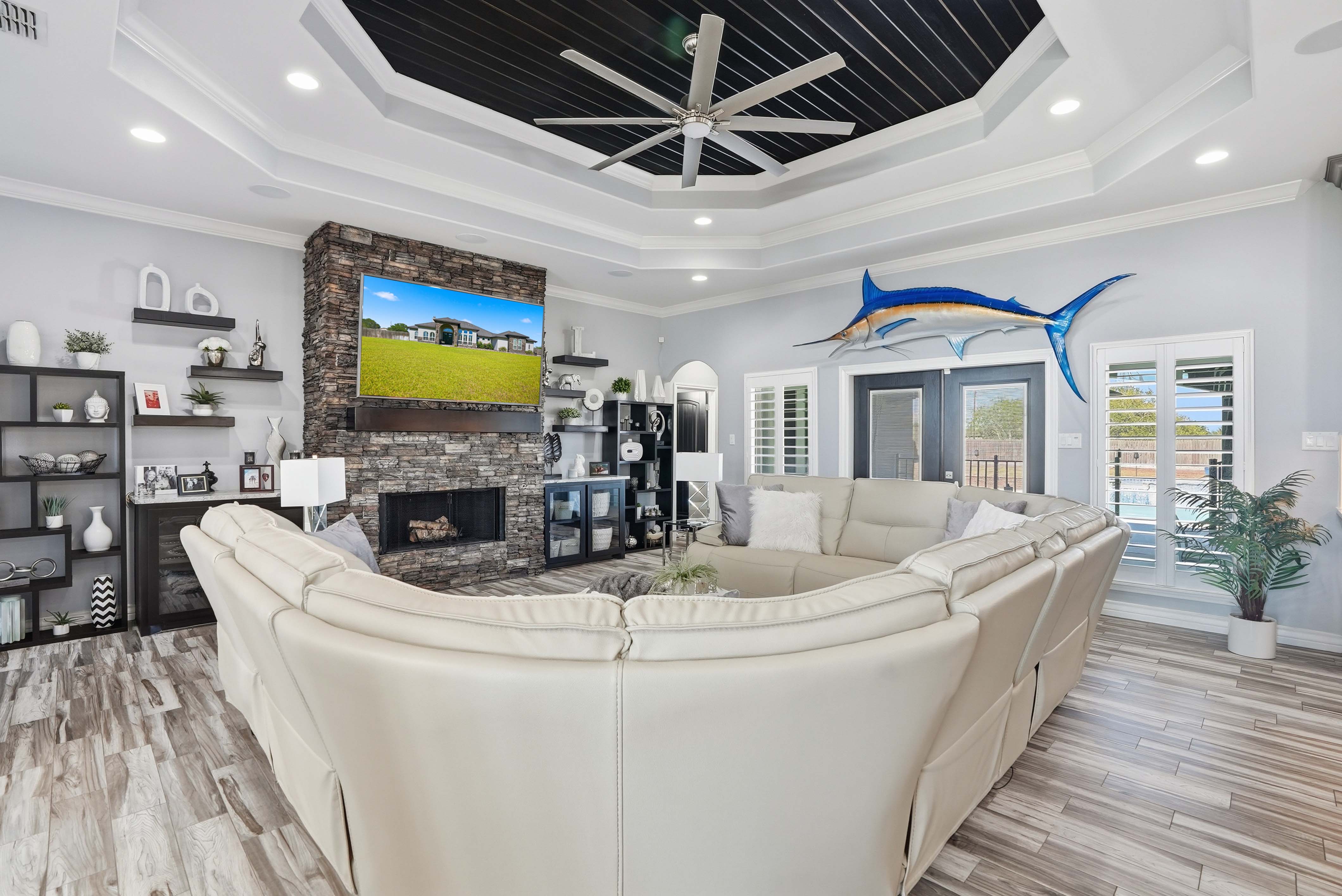
Property photography that moves listings
Professional ground-level shots showcase interiors and exteriors. Every room tells the story that brings buyers through the door.

Drone photography from above changes perspective
Aerial views reveal property boundaries, landscaping, and neighborhood context. Listings with drone photos sell faster and command better prices.
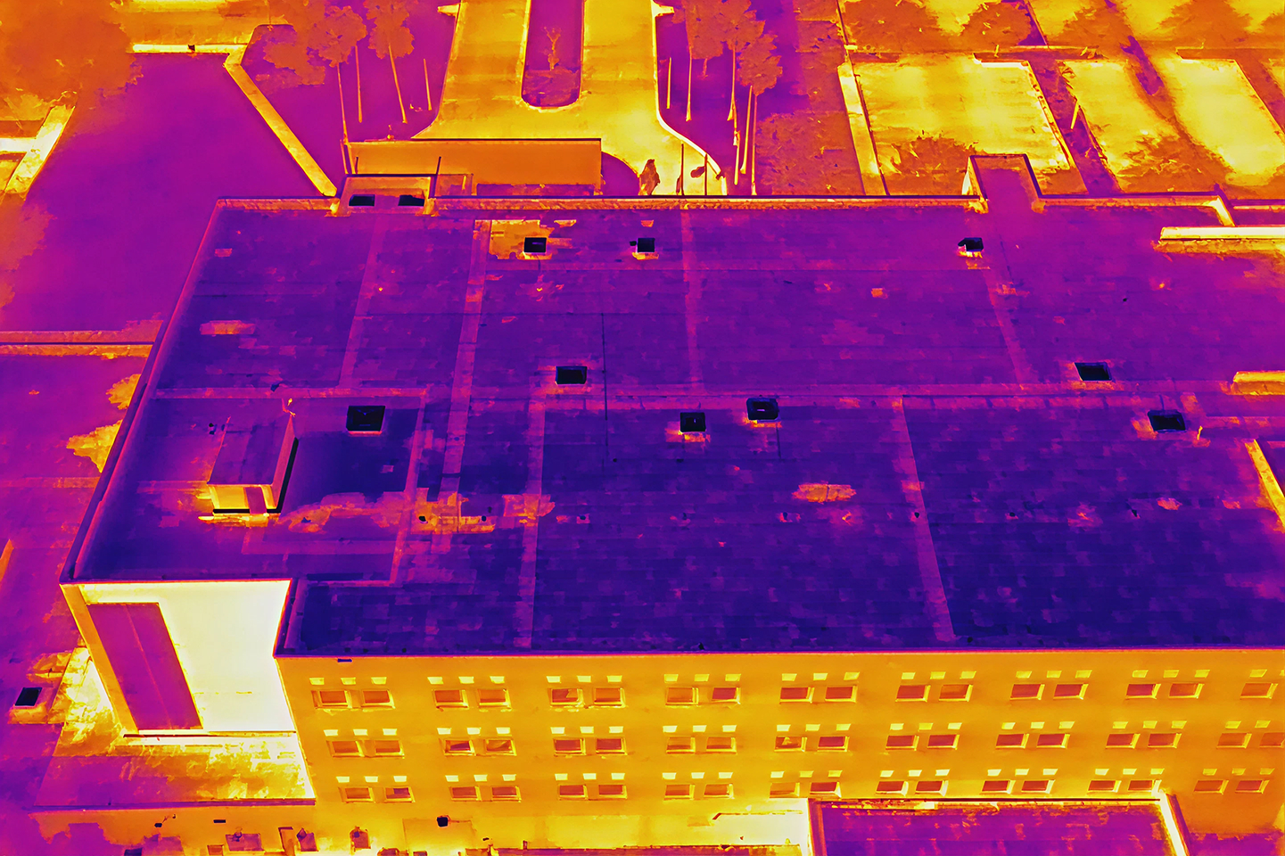
Thermal imaging finds hidden roof problems
Moisture, leaks, and insulation failures show up instantly on thermal scans. Prevent expensive repairs by knowing what's wrong before it spreads.

LiDAR mapping captures precise site data
Detailed 3D maps for construction, surveying, and planning. Accuracy that saves time and money on every project.

Drone services for oil, gas, and utilities
Infrastructure inspection, progress documentation, and asset assessment from the air. Professional imaging for operations that demand reliability.

Matterport 3D tours for remote walkthroughs
Buyers explore properties anywhere, anytime. Interactive virtual tours that feel like being there, without the drive.
What clients say about our work
Real estate agents, property managers, and commercial operators trust South Texas Photography to deliver results that matter.
"Dustin and his wife Felicia are an outstanding team!! The Photography and Drone skills are unmatched. Dustin's skills with the Drone are just spectacular. The editing is outstanding. One of the best things I like about this company is the ease in which they communicate and get things done with the clients."

"I've been a Realtor for 10 years. Had a listing in Corpus Christi, outside my normal area of work, and found South Texas Photography for my pictures. Outstanding work, amazing quality of the photos and the turn around time was so quick. I'm in love with these photos. I wish I could have them work with me in San Antonio!!"
"Dustin and Felicia are so efficient, the photography is not only professional, but they also capture the most beautiful aspects of the homes to showcase and get your real estate listings all the attention they deserve. I would never use anybody else! My listings get under contract FAST!"
FAQs
Common questions about our services, scheduling, and what you can expect from South Texas Photography.
Most real estate projects book within 24 hours. Contact us with your timeline and we'll make it work.
We are located in southern texas but we have our suitcases packed if we need to travel to any of the great 50 states. Whether you're in the city or out in the country, we reach your location with full equipment and expertise.
Yes. Rush bookings are available for real estate photography and thermal inspections. Call us directly to discuss your timeline and we'll arrange it.
Real estate packages include edited photos, aerial shots, and virtual tour options. Industrial packages vary by project scope. We customize everything to fit your needs.
Real estate photos and videos are delivered digitally within 24 hours, edited, full resolution, and ready to upload straight to your listing. Industrial projects may require additional processing time given the scope, but you'll receive the same polished, ready-to-use files.
Absolutely. We specialize in Airbnb property photography that highlights what guests want to see. Professional shots increase bookings and rental rates.
We handle construction documentation, thermal inspections, LiDAR mapping, and industrial asset assessment. All work is fully licensed and insured.
Yes. All drone operations are conducted by certified Part 107 pilots. We maintain full insurance coverage for every flight.
It's an interactive virtual walkthrough of a property. Buyers can explore every room from their computer or phone, anytime, anywhere.
Every project is different, so pricing is based on the details of yours. Contact us and we'll get you a custom quote with no guesswork.
Still have questions?
Reach out to South Texas Photography directly.